|
 |
||||
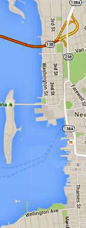
| Newport Harbor Walk
South Newport Harbor
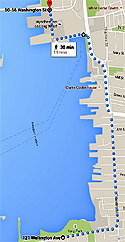
Walk North New Animated and GPS-Based Google Map Instructions [Beta Test] Also See: Newport Cliff Walk and Newport's Ten Mile Drive |
|||||
|
Since the discovery of America and its early colonization by the British, Newport specifically stood out from the rest of the colonies as it was one of the five major commercial seaports in the New World. 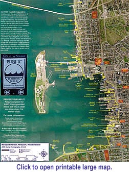 Because of its
location, resources, and geography, Newport became an ideal center for industry
and commerce to flourish and thrive. In the early seventeenth century Newport
quickly transitioned from a farming community into a bustling, growing urban
landscape in which laborers, artisans, craftsmen, and merchants alike tried to
establish their businesses and take part in the boundless opportunities that
America offered. Because of its
location, resources, and geography, Newport became an ideal center for industry
and commerce to flourish and thrive. In the early seventeenth century Newport
quickly transitioned from a farming community into a bustling, growing urban
landscape in which laborers, artisans, craftsmen, and merchants alike tried to
establish their businesses and take part in the boundless opportunities that
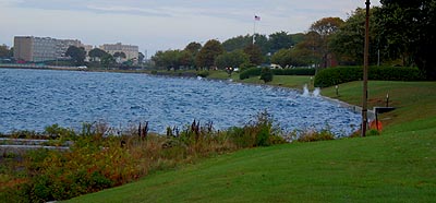
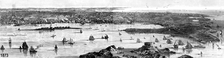
America offered. Newport continued to prosper and develop at a rapid rate throughout the seventeenth and eighteenth centuries, changing the landscape of Newport from farms and windmills to streets, neighborhoods, workshops, fishing and marine industry, and shops. However, by 1760 this growth eventually slowed and came to a stop when British-Colonial relations became tense. Restrictive trade taxes and regulations such as the Stamp, Tea, and Sugar Acts put immense strain on Newport’s economy and increased anti-British sentiments. Finally, in 1776 Newport’s maritime economy literally ground to a halt when Crown troops occupied the city only to leave when they were needed in New York. 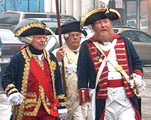 With the conclusion of the American Revolution in 1783, Newport hoped to see the rebirth of its economy. However, by this time commerce and trade had shifted northward to Providence which had been less affected by the war. Attempts to jumpstart Newport’s economy through the illegal slave trade, the whaling industry, and the textile industry in the early nineteenth century were temporary solutions and ultimately failed. Newport’s economy finally turned around in the 1830s when the city became a popular choice among affluent families from the South, New York, Boston, and Philadelphia looking for a summer seaside resort. As the socially elite began to flock to Newport and build summer homes, a huge demand for laborers, carpenters, masons, plumbers, chefs, clerks, bookkeepers, gardeners, and servants arose. In order to meet this demand, Newport underwent a drastic revitalization in which the population swelled and construction increased in order to accommodate both the visiting upper class and the growing working class. Today Newport continues to attract visitors because of its picturesque scenery, history, cultural festivals, and variety of shops just as it did since its humble beginnings. Newport Harbor Walk is broken into two segments Harbor Walk South [Main Harbor] and Harbor Walk North [The Point and Goat Island]. 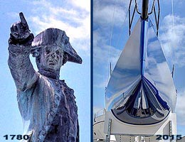 Harbor Walk South [Main Harbor]
covers Newport's "Active" harbor with a wide selection of boating, sailing,
entertainment, history, and night-time action. Here's the typical New England
waterfront that now mixes a large and active commercial boatyard and everything
from T-shirts, to trendy boutiques, to antique shops, to "Chowda" tasting, to
lobster tank looking, to tall ship sailing, to learning how to pour brass
marine fittings and bend oak ribs.
Harbor Walk South [Main Harbor]
covers Newport's "Active" harbor with a wide selection of boating, sailing,
entertainment, history, and night-time action. Here's the typical New England
waterfront that now mixes a large and active commercial boatyard and everything
from T-shirts, to trendy boutiques, to antique shops, to "Chowda" tasting, to
lobster tank looking, to tall ship sailing, to learning how to pour brass
marine fittings and bend oak ribs.While Harbor Walk South is just over two miles from Stone Pier at King Park to Newport Shipyard, the harbor explorer is exposed to multiple diversions ... this is not an area to be rushed. A walking round trip is over four miles. 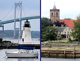 Harbor Walk North
covers Goat Island and Newport's historic residential Point Section
which was the original colonial center of the city and waterfront. While the
British managed to destroy Newport's colonial waterfront by breaking up and
burning the wood docks for heat during the War for Independence, this section
of the city has retained a surprisingly large number of colonial homes dating
in the 1700s. Combined with a number a Victorian gems, this area of Newport is
architecturally rich.
Harbor Walk North
covers Goat Island and Newport's historic residential Point Section
which was the original colonial center of the city and waterfront. While the
British managed to destroy Newport's colonial waterfront by breaking up and
burning the wood docks for heat during the War for Independence, this section
of the city has retained a surprisingly large number of colonial homes dating
in the 1700s. Combined with a number a Victorian gems, this area of Newport is
architecturally rich. The full Harbor Walk North tour starting at Storer Park to Goat Island and through the Point Section is just under three miles. |
|||||
 |
|||||
|
|||||
|
|||||